Sierra y Cañones de Guara Natural Park

Between the Pyrenees and the Ebro Valley
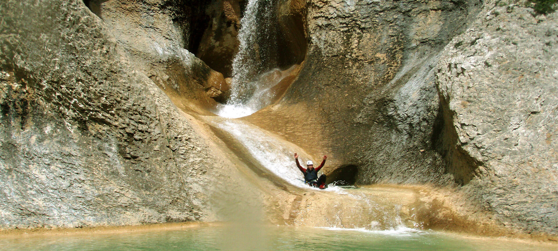
The Sierra de Guara, in the heart of the Huesca Pre-Pyrenees, is considered one of the European capitals of canyoning. These are limestone mountains crossed by several crystal-clear waterways that have created a labyrinth of gorges that is internationally renowned among lovers of this sport.
Its altitude ranges from 430 metres at the river Alcanadre to 2,077 metres at Tozal de Guara. The landscape has a karst topography, full of caves, hills, chasms and canyons. The climate is somewhere between the Atlantic and the Mediterranean, due to its location between the Pyrenees and the Ebro Valley. This marks the contrast between the vegetation in the south, which is drier and has an abundance of holm oaks, and the north, where there are leafy species such as beeches. Four main rivers cross the mountain range, creating (together with their tributaries) the characteristic canyons: The Alcanadre, the Guatizalema, the Vero and the Flumen.
Debe activar Javascript para poder utilizar este servicio
Sierra y Cañones de Guara Natural Park
Huesca (Aragón)
Huesca (Aragón):
- Abiego
- Adahuesca
- Aínsa-Sobrarbe
- Alquézar
- Arguis
- Bárcabo
- Boltaña
- Bierge
- Caldearenas
- Casbas de Huesca
- Colungo
- Huesca
- Loporzano
- Nueno
- Sabiñánigo
Activa JS
What you need to know
-
Cultural information
These mountains were populated during the Upper Paleolithic, more than 20,000 years ago, a period from which cave paintings still exist in caves such as Fuente del Trucho. It cannot be visited, but you can experience it virtually with 3D glasses at the Cave Painting Centre in Colungo, right before entering the nature reserve. It is also worth visiting picturesque towns, such as Alquézar.
-
Environmental information
The landscape has a karstic relief, with hills, caves, chasms and canyons. Its vegetation is primarily Mediterranean forest, with some enclaves of Atlantic forest and mountain grasslands. As for the fauna, the griffon vulture, the bearded vulture and the golden eagle stand out.
-
Information for visits
To gather information about the natural area and its possibilities, there are four visitor centres distributed throughout the park and its surroundings, in the towns of Bierge, Arguis, Santa Cilia de Panzano and Lecina.
Travel plans for inspiring you


